Camera drones are revolutionizing industries across the globe, offering unprecedented perspectives and capabilities that were once the realm of science fiction. These aerial marvels are not just transforming how we capture images; they’re reshaping entire sectors, from agriculture to emergency services. By combining advanced imaging technology with the flexibility of unmanned flight, drones are opening up new possibilities for efficiency, safety, and innovation. As we delve into the world of camera drones, you’ll discover how these flying cameras are becoming indispensable tools in various fields, changing the way we work, plan, and respond to challenges.
Aerial cinematography revolution in film and television production
The film and television industry has embraced camera drones with open arms, ushering in a new era of aerial cinematography. These versatile devices allow filmmakers to capture breathtaking shots that were once only possible with expensive helicopter rentals or complex crane setups. Now, you can achieve sweeping landscape views, dynamic action sequences, and intimate character moments with a level of agility and precision that was previously unattainable.
Drones equipped with high-resolution cameras can now fly closer to subjects, move through tight spaces, and perform complex maneuvers that add depth and excitement to visual storytelling. This technology has democratized aerial filming, making it accessible to independent filmmakers and smaller productions. As a result, you’re likely seeing more diverse and visually stunning content across various media platforms.
The impact of drones on cinematography extends beyond just capturing beautiful shots. They’ve also streamlined production processes, reducing setup times and crew requirements for aerial scenes. This efficiency translates to cost savings and increased creative freedom, allowing directors to experiment with shots that were once considered too risky or expensive to attempt.
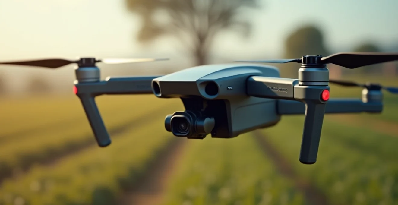
Precision agriculture: crop monitoring and management with drones
In the realm of agriculture, camera drones are cultivating a revolution in crop management. These aerial assistants are helping farmers to monitor vast fields with unprecedented detail and frequency, transforming the way agricultural operations are conducted. By providing a bird’s-eye view of crops, drones enable farmers to make data-driven decisions that optimize yields and reduce resource waste.
NDVI mapping for crop health assessment
One of the most powerful tools in a farmer’s drone arsenal is Normalized Difference Vegetation Index (NDVI) mapping. This technique uses special cameras to capture light reflected from plants, providing insights into crop health that are invisible to the naked eye. With NDVI mapping, you can identify areas of stress in your fields before they become visible, allowing for early intervention and targeted treatment.
NDVI maps created by drones can reveal:
- Variations in crop growth rates
- Areas affected by pests or diseases
- Nutrient deficiencies in specific field sections
- Water stress zones requiring immediate attention
Multispectral imaging in irrigation optimization
Drones equipped with multispectral cameras are revolutionizing irrigation practices. These advanced sensors can detect moisture levels in soil and plants, allowing for precise water management. By analyzing the data collected from multispectral imaging, you can create highly efficient irrigation plans that conserve water while ensuring optimal crop growth.
The benefits of drone-based multispectral imaging for irrigation include:
- Reduced water usage through targeted irrigation
- Prevention of over-watering and crop root damage
- Early detection of drainage issues in fields
- Improved crop quality due to consistent moisture levels
DJI agras T30 for targeted pesticide application
The DJI Agras T30 represents a significant advancement in precision agriculture. This specialized agricultural drone is designed for targeted spraying of pesticides and fertilizers. By combining high-resolution imaging with precise application technology, the Agras T30 allows farmers to apply treatments only where they’re needed, reducing chemical usage and environmental impact.
Key features of the DJI Agras T30 include:
- 40L spray tank capacity for extended operation
- Real-time terrain following for consistent spray height
- Obstacle avoidance systems for safe autonomous flight
- Integration with farm management software for data-driven decision making
Machine learning algorithms in yield prediction
The integration of machine learning algorithms with drone-captured imagery is taking yield prediction to new heights. These sophisticated AI systems can analyze vast amounts of data collected by drones throughout the growing season, considering factors such as plant health, weather patterns, and historical yield data. The result is highly accurate yield forecasts that help farmers plan harvests, manage resources, and make informed marketing decisions.
Machine learning in agriculture enables:
- Early identification of low-yielding areas for intervention
- Optimization of harvest timing for maximum crop quality
- Improved supply chain management through accurate yield estimates
- Enhanced risk assessment for crop insurance purposes
Infrastructure inspection and maintenance advancements
Camera drones are transforming the way we inspect and maintain critical infrastructure. From towering skyscrapers to sprawling power grids, these aerial devices are providing safer, more efficient means of assessing the condition of structures that are often difficult or dangerous to access. By utilizing drones, inspectors can gather detailed visual data without the need for scaffolding, cherry pickers, or putting personnel at risk.
Lidar technology for 3D modeling of structures
Light Detection and Ranging (LiDAR) technology mounted on drones is revolutionizing structural inspections. This advanced sensing method uses laser pulses to create highly accurate 3D models of buildings, bridges, and other infrastructure. With LiDAR-equipped drones, you can generate precise digital twins of structures, allowing for detailed analysis and planning of maintenance work.
The advantages of drone-based LiDAR scanning include:
- Millimeter-level accuracy in structural measurements
- Ability to penetrate vegetation for ground-level mapping
- Rapid data collection over large areas
- Creation of detailed 3D models for virtual inspections and simulations
Thermal imaging in power line inspections
Thermal imaging cameras mounted on drones are proving invaluable for power line inspections. These specialized sensors can detect heat signatures that indicate potential issues such as loose connections or overloaded transformers. By identifying these problems early, utility companies can prevent outages and reduce maintenance costs.
Thermal drone inspections offer significant benefits:
- Non-contact inspection of live electrical equipment
- Identification of hotspots before failures occur
- Reduced need for manual inspections in dangerous areas
- Improved efficiency in pinpointing exact locations of issues
Ai-powered defect detection in bridge surveys
Artificial Intelligence (AI) is enhancing the capabilities of drone inspections, particularly in bridge surveys. By combining high-resolution imagery with machine learning algorithms, drones can now automatically detect and classify structural defects such as cracks, corrosion, or displacement. This AI-powered approach significantly reduces the time and expertise required for comprehensive bridge assessments.
Key advantages of AI in drone bridge inspections:
- Consistent and objective defect identification
- Real-time analysis and reporting of structural issues
- Historical tracking of defect progression over time
- Prioritization of maintenance based on severity of detected issues
DJI matrice 300 RTK for wind turbine assessments
The DJI Matrice 300 RTK is a robust drone platform that’s changing the game for wind turbine inspections. With its advanced stabilization, long flight time, and ability to carry multiple payloads, this drone can capture detailed images of turbine blades, nacelles, and towers from various angles. The RTK (Real-Time Kinematic) positioning system ensures precise flight paths and image geotagging, critical for accurate defect mapping.
Features of the DJI Matrice 300 RTK for wind turbine inspections:
- 55-minute flight time for thorough turbine assessments
- IP45 rating for operation in challenging weather conditions
- Compatibility with various sensors, including zoom and thermal cameras
- AI-powered tracking for automated inspection routines
Emergency response and Search-and-Rescue operations
In emergency situations, time is often the most critical factor. Camera drones are proving to be game-changers in emergency response and search-and-rescue operations, providing rapid situational awareness and expanding the capabilities of first responders. These aerial assets can quickly survey large areas, access hard-to-reach locations, and provide real-time visual information to coordinate rescue efforts more effectively.
During natural disasters such as floods, earthquakes, or wildfires, drones equipped with high-resolution cameras and thermal sensors can assess damage, locate survivors, and guide rescue teams to priority areas. This bird’s-eye perspective allows emergency managers to allocate resources more efficiently and make informed decisions in high-pressure situations.
Search-and-rescue missions benefit significantly from drone technology:
- Rapid deployment for immediate area reconnaissance
- Ability to search dangerous or inaccessible terrain safely
- Thermal imaging for locating missing persons in low visibility conditions
- Live video feeds to command centers for coordinated response efforts
Moreover, drones can be used to deliver essential supplies such as medicine, food, or communication devices to isolated individuals or groups. This capability is particularly valuable in scenarios where traditional ground or air vehicles cannot reach affected areas quickly or safely.
Real estate marketing and property surveying innovations
The real estate industry has embraced camera drones as powerful tools for marketing properties and conducting surveys. These aerial platforms offer a unique perspective that can showcase properties in ways that ground-level photography simply cannot match. From sprawling estates to urban developments, drones provide potential buyers with a comprehensive view of properties and their surroundings.
360-degree virtual tours with insta360 pro 2
The Insta360 Pro 2 camera, when mounted on a drone, takes virtual property tours to new heights. This advanced 360-degree camera captures immersive footage that allows potential buyers to experience a property as if they were there. By combining aerial perspectives with 360-degree views, you can create virtual tours that give a complete sense of a property’s layout, features, and neighborhood context.
Benefits of drone-based 360-degree virtual tours include:
- Increased engagement with online property listings
- Reduced need for in-person viewings, saving time for both agents and buyers
- Ability to showcase hard-to-reach areas of large properties
- Creation of memorable, shareable content for social media marketing
Photogrammetry for accurate property measurements
Drones equipped with high-resolution cameras are revolutionizing property surveying through photogrammetry. This technique uses overlapping aerial images to create accurate 3D models and maps of properties. Photogrammetry allows for precise measurements of land areas, building dimensions, and topographical features without the need for time-consuming ground surveys.
Photogrammetry offers several advantages in real estate:
- Quick and cost-effective property boundary surveys
- Accurate volume calculations for earthwork and construction planning
- Detailed site analysis for property development projects
- Creation of interactive 3D models for marketing luxury properties
Drone-generated 3D models for urban planning
Urban planners and developers are leveraging drone technology to create detailed 3D models of cities and neighborhoods. These models serve as powerful tools for visualizing proposed developments, assessing environmental impact, and engaging with community stakeholders. By combining aerial imagery with GIS data, planners can create accurate, up-to-date representations of urban landscapes.
Applications of drone-generated 3D models in urban planning:
- Visualization of proposed buildings in existing cityscapes
- Analysis of shadow impact from new developments
- Traffic flow simulations for infrastructure planning
- Public engagement through interactive 3D city models
Environmental monitoring and wildlife conservation efforts
Camera drones are proving to be invaluable assets in environmental monitoring and wildlife conservation. These aerial platforms allow researchers and conservationists to gather data and observe wildlife with minimal disturbance to natural habitats. From tracking animal populations to monitoring deforestation, drones are providing new insights into ecosystems and helping to protect endangered species.
In forest conservation efforts, drones equipped with multispectral cameras can assess tree health, detect illegal logging activities, and monitor reforestation projects. The ability to cover large areas quickly and repeatedly allows for the detection of changes in forest cover over time, helping conservationists to respond promptly to threats.
Wildlife researchers are using drones in innovative ways:
- Counting and tracking migratory species in remote areas
- Collecting biological samples from whales using specially equipped drones
- Monitoring poaching activities in protected reserves
- Assessing the impact of climate change on animal habitats
Furthermore, drones are being employed to monitor marine environments, including coral reefs and coastal erosion. By providing a cost-effective means of surveying large bodies of water, drones are helping scientists to better understand and protect aquatic ecosystems.
As drone technology continues to advance, its applications in environmental monitoring and conservation are likely to expand, offering new tools for protecting our planet’s biodiversity and natural resources. The integration of AI and machine learning with drone-captured data promises even more sophisticated analysis and predictive modeling for environmental management.