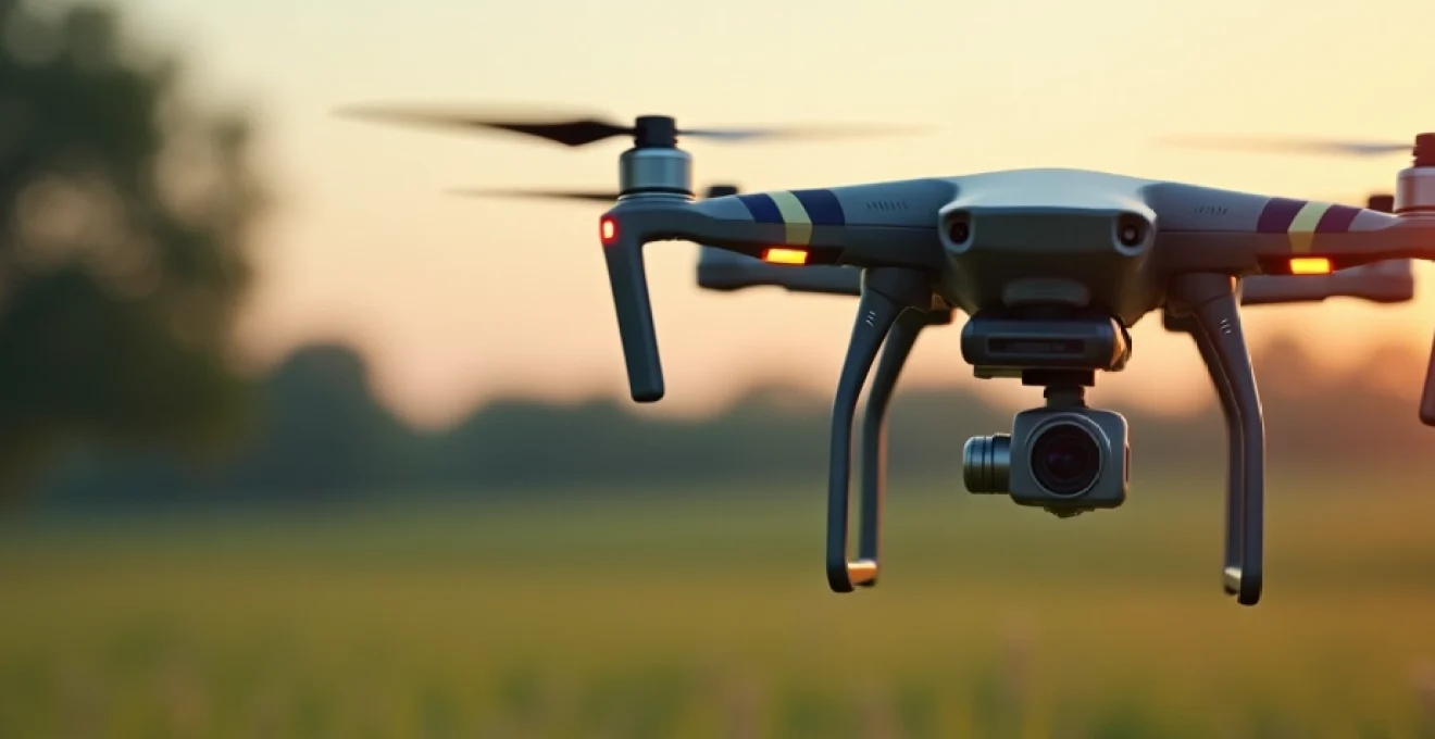
Camera drones have revolutionized various industries, offering unprecedented aerial perspectives and data collection capabilities. These unmanned aerial vehicles (UAVs) equipped with high-resolution cameras and advanced sensors are transforming the way businesses operate, from film production to agriculture and environmental conservation. As drone technology continues to evolve, its applications are expanding rapidly, providing innovative solutions to age-old challenges and opening up new possibilities for efficiency and creativity.
The versatility of camera drones has made them indispensable tools in numerous sectors. Their ability to access hard-to-reach areas, capture stunning aerial footage, and gather precise data has led to significant improvements in productivity, safety, and decision-making processes. Let’s explore how these flying marvels are being utilized across different industries and the impact they’re making.
Aerial cinematography revolution in film and television production
The film and television industry has embraced camera drones with open arms, ushering in a new era of aerial cinematography. These nimble flying cameras have become a staple on film sets, offering directors and cinematographers the ability to capture breathtaking aerial shots that were once only possible with expensive helicopter rentals or complex crane setups.
Drones equipped with stabilized gimbals and 4K or even 8K cameras can now execute smooth, dynamic shots that add production value and visual spectacle to films, TV shows, and documentaries. From sweeping landscape shots to intricate action sequences, drones provide filmmakers with unprecedented creative freedom.
One of the most significant advantages of using drones in film production is their cost-effectiveness. A drone operator and equipment can often be hired for a fraction of the cost of a helicopter crew, making high-quality aerial shots accessible to productions of all budgets. This democratization of aerial cinematography has led to a rise in visually stunning content across various media platforms.
Moreover, drones can access locations that would be impossible or too dangerous for traditional filming methods. They can fly through narrow spaces, hover close to the ground, or even navigate indoor environments, allowing for unique and immersive perspectives that enhance storytelling.
The integration of camera drones has not only elevated the visual quality of productions but has also streamlined the filming process, allowing for faster setups and more efficient shooting schedules.
Precision agriculture: crop monitoring and field mapping with drones
In the agricultural sector, camera drones have become powerful tools for precision farming, revolutionizing the way farmers monitor crops and manage their fields. These aerial platforms equipped with specialized sensors and cameras provide farmers with valuable data that can significantly improve crop yields and reduce resource waste.
NDVI analysis for crop health assessment
One of the most valuable applications of drones in agriculture is the use of Normalized Difference Vegetation Index (NDVI) analysis. Drones equipped with multispectral cameras can capture images that reveal the health and vigor of crops based on their reflection of near-infrared light. This technology allows farmers to identify areas of stress in their fields, detect pest infestations, and optimize irrigation and fertilizer application.
By using NDVI maps generated from drone imagery, farmers can make data-driven decisions about crop management, targeting specific areas that need attention rather than treating entire fields uniformly. This precision approach not only improves crop health but also reduces the environmental impact of farming practices.
DJI P4 multispectral for detailed soil analysis
The DJI P4 Multispectral drone has become a popular choice among agricultural professionals for its ability to provide detailed soil analysis. This specialized drone combines RGB and multispectral imaging capabilities to offer insights into soil composition, moisture levels, and nutrient content.
By analyzing the data collected by the P4 Multispectral, farmers can create precise soil maps that inform their planting strategies, irrigation plans, and fertilizer applications. This level of detail allows for optimized resource allocation , ultimately leading to increased productivity and reduced environmental impact.
Automated spraying systems using DJI agras T30
The DJI Agras T30 represents the next generation of agricultural drones, featuring automated spraying systems that can apply pesticides, herbicides, and fertilizers with unprecedented precision. This drone can cover large areas quickly and efficiently, reducing labor costs and minimizing chemical usage.
The Agras T30’s intelligent spraying system adjusts its output based on flight speed and crop coverage, ensuring uniform application and reducing waste. This technology not only improves the effectiveness of treatments but also helps farmers comply with environmental regulations by minimizing chemical runoff.
Ai-powered yield prediction with sentera PHX Fixed-Wing
The Sentera PHX Fixed-Wing drone takes crop monitoring to new heights with its AI-powered yield prediction capabilities. This advanced drone can capture high-resolution imagery over large areas, which is then analyzed using machine learning algorithms to predict crop yields with remarkable accuracy.
Farmers can use these predictions to make informed decisions about harvest timing, storage requirements, and market strategies. The ability to forecast yields accurately can have significant financial implications, allowing farmers to optimize their operations and negotiate better contracts with buyers.
Infrastructure inspection and maintenance via drone technology
The infrastructure sector has seen a significant transformation in inspection and maintenance practices thanks to the adoption of camera drones. These aerial platforms offer a safe, efficient, and cost-effective way to inspect large-scale structures and facilities, from bridges and buildings to power lines and industrial complexes.
Power line surveys using thermal imaging drones
Thermal imaging drones have become invaluable tools for power line surveys, allowing utility companies to detect potential issues before they lead to outages or safety hazards. These specialized drones equipped with thermal cameras can identify hot spots on power lines, transformers, and other electrical equipment that may indicate impending failures.
By conducting regular thermal inspections with drones, utilities can prioritize maintenance tasks, reduce the risk of equipment failure, and minimize downtime. This proactive approach not only improves the reliability of the power grid but also enhances worker safety by reducing the need for manual inspections in hazardous environments.
Bridge inspection with LiDAR-Equipped UAVs
LiDAR-equipped drones have revolutionized bridge inspection processes, offering a level of detail and accuracy that was previously unattainable. These drones use laser scanning technology to create highly precise 3D models of bridge structures, allowing engineers to detect even the smallest defects or changes over time.
The use of LiDAR drones for bridge inspections not only improves the quality of assessments but also significantly reduces the time and cost associated with traditional inspection methods. Engineers can now inspect hard-to-reach areas of bridges without the need for expensive scaffolding or putting workers at risk.
Oil and gas pipeline monitoring with Long-Range drones
Long-range drones have become essential tools for monitoring vast networks of oil and gas pipelines. These UAVs can cover extensive distances, capturing high-resolution imagery and sensor data to detect leaks, corrosion, or unauthorized activities along pipeline routes.
By implementing regular drone surveys, pipeline operators can identify potential issues early , reducing the risk of environmental damage and improving overall system integrity. The efficiency of drone-based monitoring also allows for more frequent inspections, enhancing the safety and reliability of pipeline networks.
Wind turbine blade analysis using High-Resolution cameras
Wind turbine maintenance has been significantly enhanced by the use of drones equipped with high-resolution cameras. These UAVs can capture detailed images of turbine blades, allowing technicians to identify damage, erosion, or other issues that could affect performance or safety.
Drone inspections of wind turbines are not only faster and more cost-effective than traditional methods but also much safer. By eliminating the need for technicians to climb turbines or use rope access techniques, drones have dramatically reduced the risks associated with wind farm maintenance.
Urban planning and real estate marketing with aerial imagery
In the realm of urban planning and real estate, camera drones have become indispensable tools for capturing comprehensive aerial views and creating detailed 3D models of cities and properties. These aerial platforms provide urban planners, developers, and real estate professionals with invaluable perspectives that inform decision-making and enhance marketing efforts.
For urban planners, drone imagery offers a bird’s-eye view of cityscapes, allowing for better analysis of traffic patterns, green spaces, and urban sprawl. This data can be used to create more efficient and sustainable city layouts, improving the quality of life for residents. Additionally, drones can capture time-lapse footage of urban development, providing valuable insights into how cities change over time.
In the real estate sector, drones have transformed property marketing. High-quality aerial photographs and videos showcase properties in their entirety, highlighting features such as landscaping, proximity to amenities, and the overall neighborhood context. This comprehensive view helps potential buyers make more informed decisions and can significantly enhance the appeal of listings.
Aerial imagery captured by drones provides a powerful visual tool that can influence urban development strategies and revolutionize how properties are presented to the market.
Environmental conservation and wildlife monitoring through drone surveys
Environmental conservationists and wildlife researchers have embraced drone technology as a powerful ally in their efforts to protect ecosystems and study animal populations. Camera drones offer a non-invasive way to monitor wildlife and assess environmental changes, providing valuable data that informs conservation strategies.
Coral reef mapping with underwater drone systems
Specialized underwater drone systems are being used to map and monitor coral reefs, offering unprecedented insights into these delicate ecosystems. These aquatic drones can capture high-resolution imagery and collect data on water quality, temperature, and marine life populations without causing disturbance to the environment.
By creating detailed maps of coral reefs, researchers can track changes over time, assess the impact of climate change, and develop targeted conservation efforts. This technology has proven particularly valuable in monitoring the health of remote or deep-water reefs that are difficult to access through traditional diving methods.
Forest fire detection using parrot ANAFI thermal
The Parrot ANAFI Thermal drone has become an essential tool in forest fire prevention and management. Equipped with both visual and thermal cameras, this drone can detect hotspots and potential fire outbreaks before they become visible to the naked eye.
Forest rangers and firefighters use these drones to conduct regular surveys of at-risk areas, allowing for early detection and rapid response to wildfires. The thermal imaging capabilities also help in monitoring active fires, providing crucial information for firefighting strategies and ensuring the safety of ground crews.
Anti-poaching efforts enhanced by silent drone patrols
In the fight against wildlife poaching, silent drones have emerged as a game-changing technology. These specially designed UAVs can patrol large areas of wildlife reserves without alerting poachers to their presence, providing real-time surveillance and alerting rangers to suspicious activities.
Equipped with thermal cameras and night vision capabilities, these drones can operate 24/7, significantly extending the reach and effectiveness of anti-poaching efforts. The use of drones has not only improved the detection of poachers but also serves as a powerful deterrent, helping to protect endangered species in some of the world’s most vulnerable ecosystems.
Polar ice cap monitoring with Fixed-Wing endurance drones
Fixed-wing endurance drones are playing a crucial role in monitoring polar ice caps and tracking the effects of climate change. These long-range UAVs can cover vast areas of Arctic and Antarctic regions, capturing high-resolution imagery and collecting data on ice thickness, temperature, and melt rates.
The data collected by these drones provides scientists with valuable insights into the pace of global warming and its impact on polar ecosystems. This information is critical for climate modeling and informing policy decisions aimed at mitigating the effects of climate change.
Emergency response and Search-and-Rescue operations augmented by drones
In emergency response and search-and-rescue operations, time is often the most critical factor. Camera drones have emerged as invaluable assets in these high-stakes scenarios, providing rapid situational awareness and expanding the capabilities of first responders.
During natural disasters such as floods, earthquakes, or hurricanes, drones can quickly survey affected areas, assess damage, and locate survivors. This aerial perspective allows emergency teams to prioritize their efforts and allocate resources more effectively. Thermal imaging drones are particularly useful in locating individuals trapped in rubble or dense vegetation, even in low-light conditions.
For search-and-rescue missions in remote or challenging terrain, drones equipped with high-zoom cameras and GPS tracking can cover large areas much faster than ground teams. These UAVs can not only locate missing persons but also deliver essential supplies like food, water, or medical kits to those in need before rescuers can reach them.
Moreover, drones are being used to create real-time maps of disaster zones, providing incident commanders with up-to-date information to coordinate relief efforts. This dynamic mapping capability is particularly valuable in rapidly changing situations, such as wildfires or flood events.
The integration of drones into emergency response protocols has significantly enhanced the speed and effectiveness of rescue operations, ultimately saving lives and reducing risks for first responders. As drone technology continues to advance, its role in emergency management is likely to become even more prominent, with AI-assisted analysis and autonomous operation capabilities further improving response times and outcomes.